© 2020 Jerry D. Patillo
Now we need to define some cartographic terms:
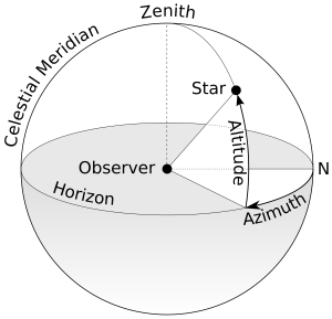
- azimuthal = Describing a map projection that preserves direction for all points relative to a selected point (e.g., the North Pole, or Dallas, Texas, or 0° north 90° west). [https://en.wiktionary.org/wiki/azimuthal]
- Examples of azimuthal maps (q.v.):
- Azimuthal equidistant
- Lambert azimuthal equal-area
- Orthographic

- equidistant = All distances from one (or two) points are correct. Other equidistant properties are mentioned in the notes. [https://en.wikipedia.org/wiki/List_of_map_projections]
- Examples of equidistant maps (q.v.):
- Equirectangular (Plate Carrée)
- Equidistant Conic
- Azimuthal Equidistant
~~~~~~~~~~
- map projection = A systematic presentation of intersecting coordinate lines on a flat surface upon which features from a curved surface (as of the earth or the celestial sphere) may be mapped [https://www.merriam-webster.com/dictionary/projection]
- Examples of types of map projections (q.v.):
- cylindrical
- Plate Carrée (Equirectangular)
- Mercator
- Miller
- conic
- Albers Equal Area
- Equidistant
- Lambert Conformal
- azimuthal
- Lambert Azimuthal Equal-area
- Orthographic
- Azimuthal Equidistant
- cylindrical
- Examples of the properties of map projections (q.v.):
- equidistant
- Plate Carée
- Equidistant Conic
- Azimuthal Equidistant
- conformal
- Mercator
- Transverse Mercator
- Lambert Conformal Conic
- equal-area
- Lambert Cylindrical
- Mollweide
- Eckert VI
- compromise
- Miller
- Robinson
- Winkel Tripel
- equidistant
~~~~~~~~~~
- A few examples of projections [https://en.wikipedia.org/wiki/Map_projection]:
An Albers projection shows areas accurately, but distorts shapes.
A Miller cylindrical projection maps the globe onto a cylinder.
The Robinson projection was adopted by National Geographic magazine in 1988 but abandoned by them in about 1997 for the Winkel tripel.
~~~~~~~~~~
- azimuthal equidistant projection = A map projection that has the useful properties that all points on the map are at proportionally correct distances from the center point, and that all points on the map are at the correct azimuth (direction) from the center point. A useful application for this type of projection is a polar projection which shows all meridians (lines of longitude) as straight, with distances from the pole represented correctly. The flag of the United Nations contains an example of a polar azimuthal equidistant projection.
[https://en.wikipedia.org/wiki/Azimuthal_equidistant_projection]
- oblate = Flattened or depressed at the poles. [https://en.wiktionary.org/wiki/oblate]
- spheroid = A shape similar to a squashed sphere. [https://en.wiktionary.org/wiki/spheroid]
- oblate spheroid = A sphere squashed from the top so the circumference around the poles is less than the circumference around the equator.
Examples of a sphere [https://images.search.yahoo.com/…]:
Examples of an oblate spheroid [https://images.search.yahoo.com/…]:
- latitude = The angular distance north or south from a planet’s equator, measured along the meridian of that particular point. [https://en.wiktionary.org/wiki/latitude]
90n90w
45N90W
0°N (=0°S) 90°W
45S 90W
90S 90W
- longitude = Angular distance measured west or east of the prime meridian. Any imaginary line perpendicular to the equator and part of a great circle passing through the North Pole and South Pole. [https://en.wiktionary.org/wiki/longitude]
0s 0w
0s 90w
0s 180w (=180e)
0s 270w (=90e)